
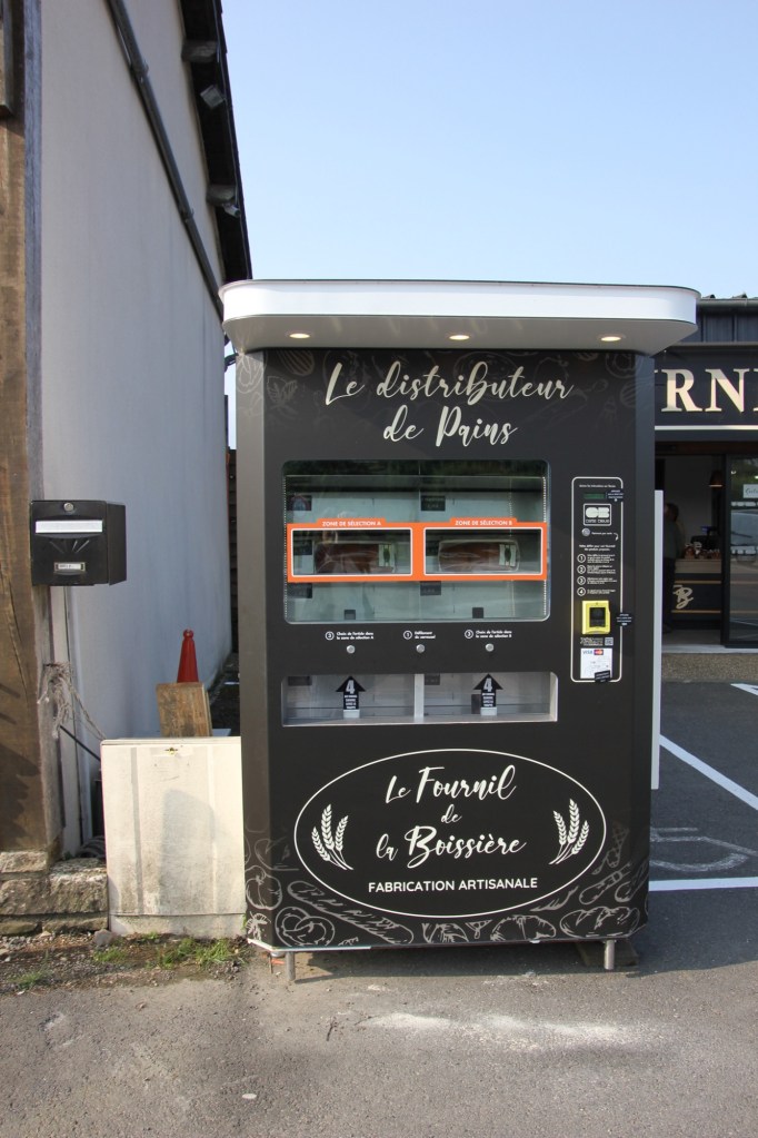
We started our day with a visit to our local bakery. The offerings are wonderful and we dove into the deliciousness of pastries. We are lucky to have our “local”. Many local bakeries are closing and baguette vending machines are put in many locations to ensure people get their daily bread.
We learned a lesson today about not trusting our GPS or our understanding of the French countryside. Many places have similar names and we started by picking the wrong Jumieges. We were looking for the ruined Abby of Jumieges. The good news was that we got to see some beautiful scenery on the way to the correct coordinates. We were almost at our destination when the road ended suddenly and the Seine river appeared in front of us. We quickly figured out that we had to take a ferry across and luckily we were first in line for the ferry. The crossing was quick and we celebrated by stopping for lunch at a restaurant just outside the Abby. We were happy we made the journey.
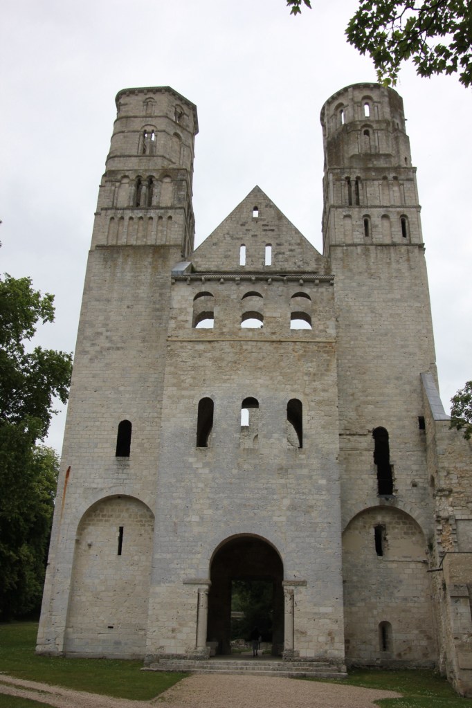
The Abby Nave is 25 m tall over 3 levels and the towers are 45m tall.
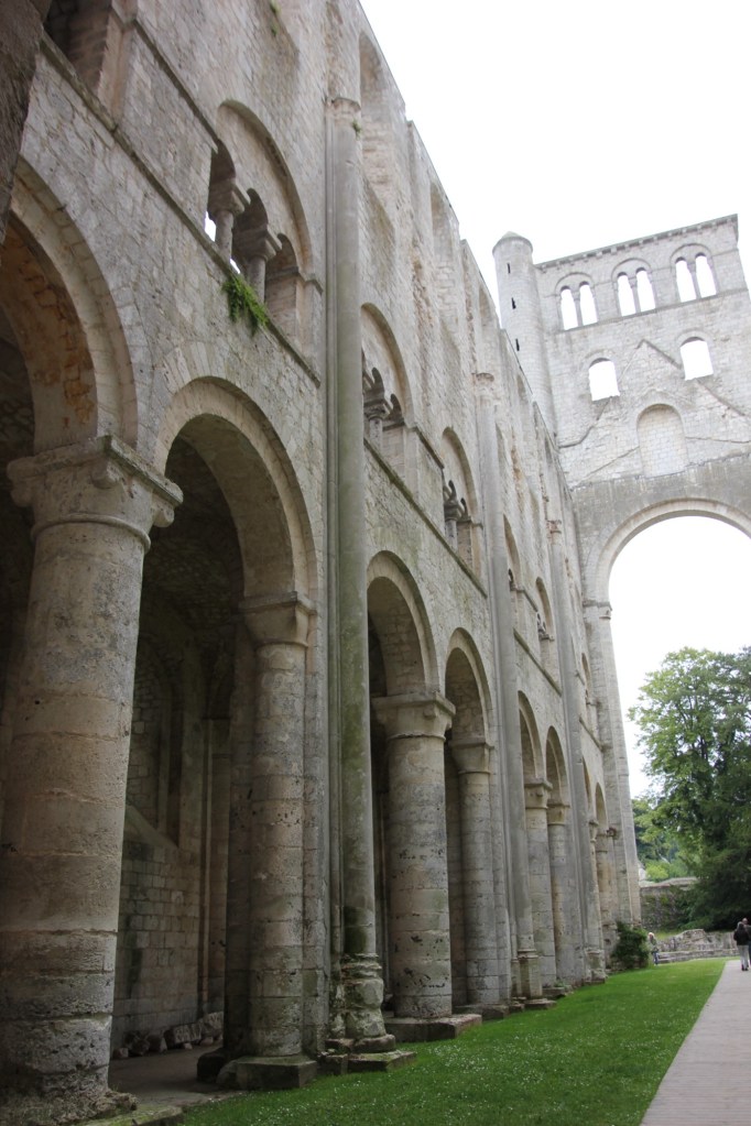
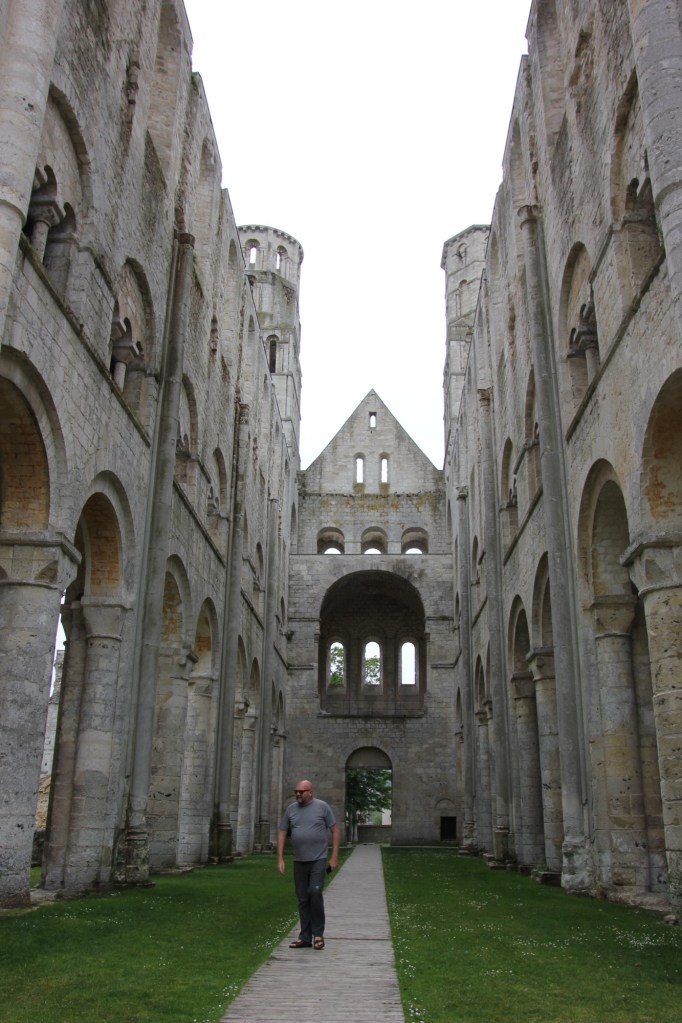
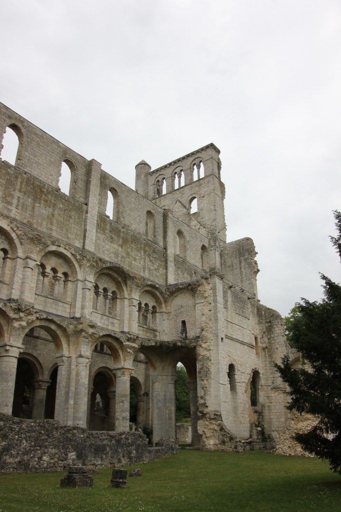
The Abby has had a somewhat tortured history. It was founded in 654 AD as a Benedictine monastery but was destroyed by Vikings in 841. It was rebuilt by 940 and destroyed again only to be upgraded in 1040 and consecrated in the presence of William the Conquerer in 1067. The Abby did well after that until the 100 years war (1337-1453) brought on a depression due to taxation and poverty. The Abby survived as an important centre of knowledge and learning until the French Revolution when the monastery was dissolved and it was sold for quarry materials. It was systematically dismantled as people took the stone for other projects. Only 30% of the original buildings remain. It is still an impressive structure and it continues to draw people to it.
We have deliberately used secondary roads and highways to a) see the countryside and b) avoid paying tolls. This has led us to value traffic circles as efficient ways of getting through communities without stopping for lights. The GPS in our car is also a useful tool. It tells us what the speed limits are and beeps at us if we start speeding. This is helpful because the limits change regularly and without notice (or apparent reason).
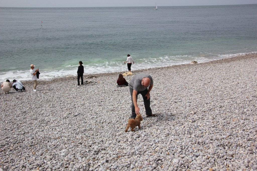
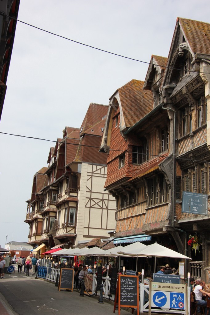
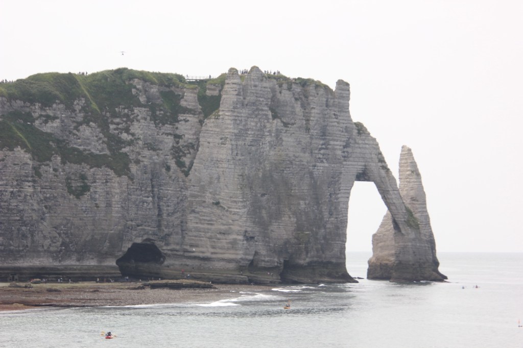
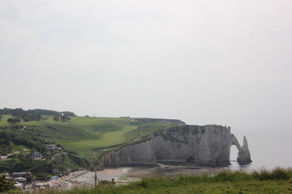
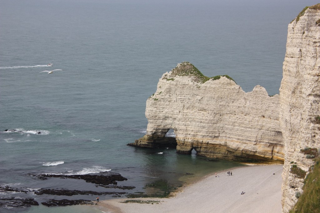
We had no difficulties winding our way to our next destination, Etretat, a coastal community on the English Channel. Going to bathe in the sea became popular in the mid-1800s and Etretat became known for its pebbled beaches and white chalk cliffs. It has inspired painters like Monet and Turner and continues to pull people from all walks of life. We walked on the beach and looked up at the church on the cliff. People were making the 90m climb but we decided to first get ice cream and then take the tourist train to the top. It was worth the view.
We ended our day back at our country retreat. We had a simple supper and, confirming how rural our place is, we watched a fawn run by the window while we ate. The bird song here is amazing and we have no neighbours for at least 1km on either side. I am not sure how we will face Paris!
